
Current Projects
BioCube: Integrating remote sensing and in-situ dimensions of biodiversity to understand plant and animal community composition and dynamics at large scales
New and ongoing imaging spectroscopy, thermal, lidar, and radar satellite missions enable improved mapping of biodiversity in space and time, while comprehensive camera trap networks provide in-situ spatially and temporally explicit wildlife mapping. The BioCube initiative seeks to assemble an open-source data cube framework which combines satellite and in-situ layers, integrating vegetation structure, plant physiology, phenology, ecosystem function, climate, abiotic landscape variables, anthropogenic modifications, plant and wildlife species community compositions, and animal behavior and habitat use, all on a common spatiotemporal grid at 1 km resolution.
This project seeks to address a few key questions using BioCubes covering California and Wisconsin:
- How are these dimensions of biodiversity related to one another, and what is the predictability of in-situ species richness and diversity from space-based remote sensing data?
- What are the roles of functional, taxonomic, phylogenetic and spectral diversity in predicting the magnitude and stability of ecosystem function at large spatial scales?
- How well do the BioCube remote sensing dimensions predict animal community composition and biodiversity using matrix dissimilarity and macroecological models?
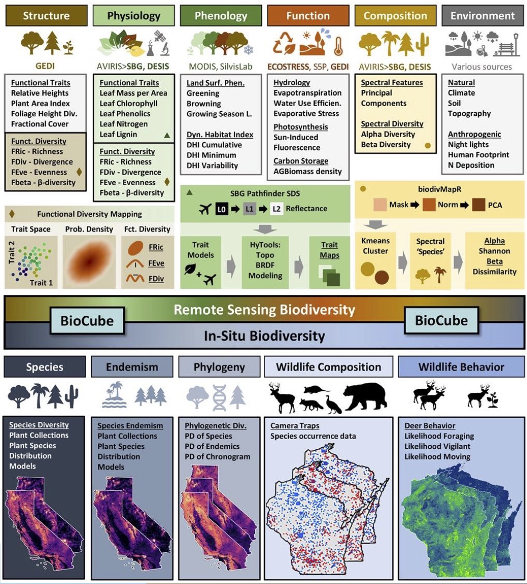
Image credit to Ryan Pavlick and Fabian Schneider.